
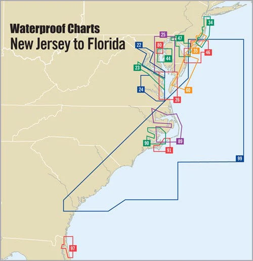
Cape May, NJ to Savannah, GA Waterproof Chart, 2nd Edition
Navigate the waters with confidence using the Cape May, NJ to Savannah, GA Waterproof Chart, 2nd Edition. This essential chart serves both offshore fishing enthusiasts and cruising adventurers, providing clear and detailed coverage from Delaware Bay all the way down to Georgia, extending up to 150 miles offshore.
Crafted specifically for maritime use, this waterproof chart is your reliable companion for planning your next voyage. The chart features over 30 pre-plotted GPS waypoints that are assigned to major aids to navigation along the coast, making it easier than ever to plot your journey effectively.
- Comprehensive Coverage: With an approximate scale of 1:592,000, this chart encompasses a wide area, ensuring you have the information you need wherever your adventures may take you.
- Durable and Waterproof: Made to withstand the elements, this waterproof chart is perfect for boating, fishing, and any maritime activity. You can trust that it will hold up against splashes, rain, and the sea.
Whether you're a seasoned mariner or a recreational boater, the Cape May, NJ to Savannah, GA Waterproof Chart is designed to enhance your navigation experience. Don't leave your safety to chance; equip yourself with this high-quality chart. It's not just about getting where you are going; it's about reaching your destination with peace of mind.
Informations sur le produit
Informations sur le produit
Livraison et retours
Livraison et retours

Cape May, NJ to Savannah, GA Waterproof Chart, 2nd Edition
Cape May, NJ to Savannah, GA Waterproof Chart, 2nd Edition
Navigate the waters with confidence using the Cape May, NJ to Savannah, GA Waterproof Chart, 2nd Edition. This essential chart serves both offshore fishing enthusiasts and cruising adventurers, providing clear and detailed coverage from Delaware Bay all the way down to Georgia, extending up to 150 miles offshore.
Crafted specifically for maritime use, this waterproof chart is your reliable companion for planning your next voyage. The chart features over 30 pre-plotted GPS waypoints that are assigned to major aids to navigation along the coast, making it easier than ever to plot your journey effectively.
- Comprehensive Coverage: With an approximate scale of 1:592,000, this chart encompasses a wide area, ensuring you have the information you need wherever your adventures may take you.
- Durable and Waterproof: Made to withstand the elements, this waterproof chart is perfect for boating, fishing, and any maritime activity. You can trust that it will hold up against splashes, rain, and the sea.
Whether you're a seasoned mariner or a recreational boater, the Cape May, NJ to Savannah, GA Waterproof Chart is designed to enhance your navigation experience. Don't leave your safety to chance; equip yourself with this high-quality chart. It's not just about getting where you are going; it's about reaching your destination with peace of mind.
Informations sur le produit
Informations sur le produit
Livraison et retours
Livraison et retours
Description
Navigate the waters with confidence using the Cape May, NJ to Savannah, GA Waterproof Chart, 2nd Edition. This essential chart serves both offshore fishing enthusiasts and cruising adventurers, providing clear and detailed coverage from Delaware Bay all the way down to Georgia, extending up to 150 miles offshore.
Crafted specifically for maritime use, this waterproof chart is your reliable companion for planning your next voyage. The chart features over 30 pre-plotted GPS waypoints that are assigned to major aids to navigation along the coast, making it easier than ever to plot your journey effectively.
- Comprehensive Coverage: With an approximate scale of 1:592,000, this chart encompasses a wide area, ensuring you have the information you need wherever your adventures may take you.
- Durable and Waterproof: Made to withstand the elements, this waterproof chart is perfect for boating, fishing, and any maritime activity. You can trust that it will hold up against splashes, rain, and the sea.
Whether you're a seasoned mariner or a recreational boater, the Cape May, NJ to Savannah, GA Waterproof Chart is designed to enhance your navigation experience. Don't leave your safety to chance; equip yourself with this high-quality chart. It's not just about getting where you are going; it's about reaching your destination with peace of mind.


