✨ Nouveautés fraîchement arrivées !Explorer

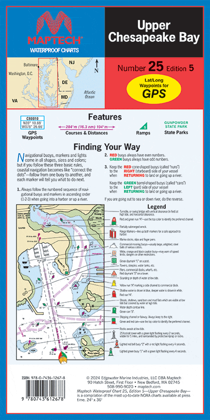
Upper Chesapeake Bay Waterproof Chart, 5th Edition
C&D Canal to the Potomac River. Featuring waypoints for major buoys, courses and distances, and ramp locations and information. Great planning chart. 24 x 36, scale 1:114,000.
Informations sur le produit
Informations sur le produit
Livraison et retours
Livraison et retours
Upper Chesapeake Bay Waterproof Chart, 5th Edition
Upper Chesapeake Bay Waterproof Chart, 5th Edition
C&D Canal to the Potomac River. Featuring waypoints for major buoys, courses and distances, and ramp locations and information. Great planning chart. 24 x 36, scale 1:114,000.
$27.95
Upper Chesapeake Bay Waterproof Chart, 5th Edition—
$27.95
Informations sur le produit
Informations sur le produit
Livraison et retours
Livraison et retours
Description
C&D Canal to the Potomac River. Featuring waypoints for major buoys, courses and distances, and ramp locations and information. Great planning chart. 24 x 36, scale 1:114,000.


