✨ Nouveautés fraîchement arrivées !Explorer

Hudson River Waterproof Chart, 7th Edition
New York City and Liberty Island to the Troy Lock. The best Hudson River chart! Featuring ramp locations, information and historic sites. 14" x 60", scale 1:53,333.
Informations sur le produit
Informations sur le produit
Livraison et retours
Livraison et retours
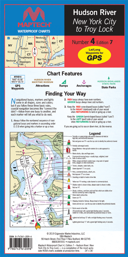

Hudson River Waterproof Chart, 7th Edition
Hudson River Waterproof Chart, 7th Edition
New York City and Liberty Island to the Troy Lock. The best Hudson River chart! Featuring ramp locations, information and historic sites. 14" x 60", scale 1:53,333.
$8.38
Original : $27.95
-70%Hudson River Waterproof Chart, 7th Edition—
$27.95
$8.38Informations sur le produit
Informations sur le produit
Livraison et retours
Livraison et retours
Description
New York City and Liberty Island to the Troy Lock. The best Hudson River chart! Featuring ramp locations, information and historic sites. 14" x 60", scale 1:53,333.


