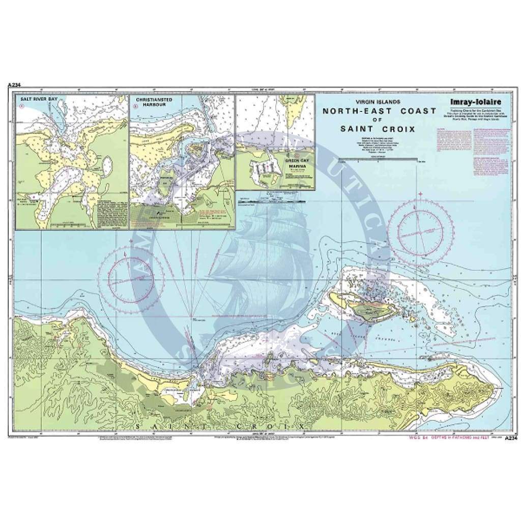
Imray Chart A234: Northeast Coast of St Croix
A234 Northeast Coast of St Croix
Scale: 1:27,700 WGS 84
Imray
Caribbean Sea - Virgin Islands
Plans include:
Salt River Bay
Christiansted Harbour
Green Cay Marina
Water-Resistant Folded – This chart is Water-Resistant, folded, and in a plastic wallet or flat. Sheet size 640 x 900mm.
Water-Resistant Rolled – This is a water-resistant print on demand (POD) chart that is printed up to date and is ideal for framing.
Informations sur le produit
Informations sur le produit
Livraison et retours
Livraison et retours

Imray Chart A234: Northeast Coast of St Croix
Imray Chart A234: Northeast Coast of St Croix
A234 Northeast Coast of St Croix
Scale: 1:27,700 WGS 84
Imray
Caribbean Sea - Virgin Islands
Plans include:
Salt River Bay
Christiansted Harbour
Green Cay Marina
Water-Resistant Folded – This chart is Water-Resistant, folded, and in a plastic wallet or flat. Sheet size 640 x 900mm.
Water-Resistant Rolled – This is a water-resistant print on demand (POD) chart that is printed up to date and is ideal for framing.
Original : $433,000.00
-70%$433,000.00
$129,900.00Informations sur le produit
Informations sur le produit
Livraison et retours
Livraison et retours
Description
A234 Northeast Coast of St Croix
Scale: 1:27,700 WGS 84
Imray
Caribbean Sea - Virgin Islands
Plans include:
Salt River Bay
Christiansted Harbour
Green Cay Marina
Water-Resistant Folded – This chart is Water-Resistant, folded, and in a plastic wallet or flat. Sheet size 640 x 900mm.
Water-Resistant Rolled – This is a water-resistant print on demand (POD) chart that is printed up to date and is ideal for framing.