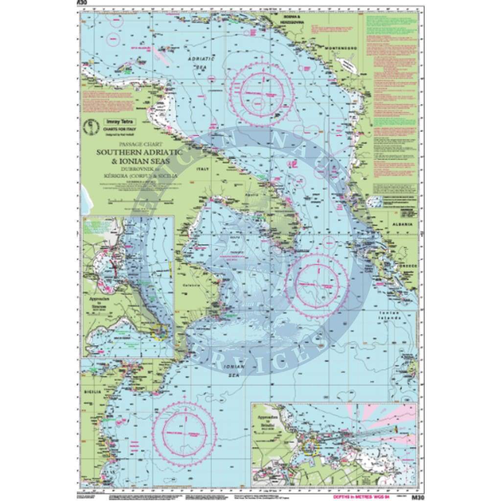
Imray Chart M30: Southern Adriatic and Ionian Seas
M30 Southern Adriatic and Ionian Seas
Dubrovnik to Kérkira (Corfu) & Sicilia
Scale: 1:850 000 WGS84
Imray
Plans included:
Approaches to Brindisi (1:35 000)
Approaches to Siracusa (1:50 000)
For this 2015 edition, the amended TSS at Brindisi is now shown along with revised depths.
Waterproof Folded – This chart is waterproof, folded, and in a plastic wallet or flat. Sheet size 640 x 900mm.
Water-Resistant Rolled – This is a water-resistant print on demand (POD) chart that is printed up to date and is ideal for framing.
Informations sur le produit
Informations sur le produit
Livraison et retours
Livraison et retours

Imray Chart M30: Southern Adriatic and Ionian Seas
Imray Chart M30: Southern Adriatic and Ionian Seas
M30 Southern Adriatic and Ionian Seas
Dubrovnik to Kérkira (Corfu) & Sicilia
Scale: 1:850 000 WGS84
Imray
Plans included:
Approaches to Brindisi (1:35 000)
Approaches to Siracusa (1:50 000)
For this 2015 edition, the amended TSS at Brindisi is now shown along with revised depths.
Waterproof Folded – This chart is waterproof, folded, and in a plastic wallet or flat. Sheet size 640 x 900mm.
Water-Resistant Rolled – This is a water-resistant print on demand (POD) chart that is printed up to date and is ideal for framing.
Original : $34.95
-70%$34.95
$10.49Informations sur le produit
Informations sur le produit
Livraison et retours
Livraison et retours
Description
M30 Southern Adriatic and Ionian Seas
Dubrovnik to Kérkira (Corfu) & Sicilia
Scale: 1:850 000 WGS84
Imray
Plans included:
Approaches to Brindisi (1:35 000)
Approaches to Siracusa (1:50 000)
For this 2015 edition, the amended TSS at Brindisi is now shown along with revised depths.
Waterproof Folded – This chart is waterproof, folded, and in a plastic wallet or flat. Sheet size 640 x 900mm.
Water-Resistant Rolled – This is a water-resistant print on demand (POD) chart that is printed up to date and is ideal for framing.