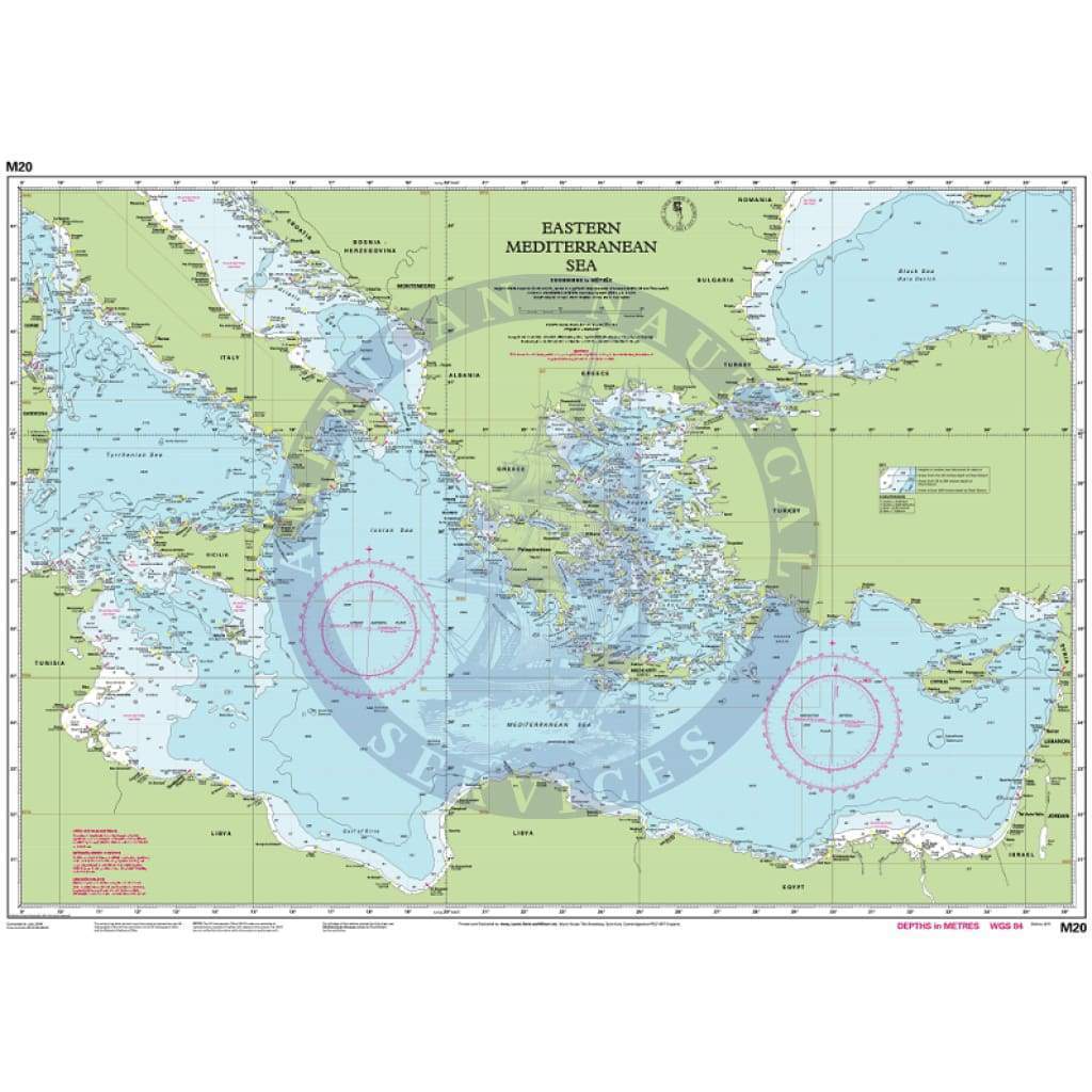
Imray Chart M20: Eastern Mediterranean
M20 Eastern Mediterranean
Sardinia to Port Said and the Black Sea
Scale: 1:2,750,000 WGS84
Waterproof Folded – This chart is waterproof, folded, and in a plastic wallet or flat. Sheet size 640 x 900mm.
Water-Resistant Rolled – This is a water-resistant print on demand (POD) chart that is printed up to date and is ideal for framing.
Informations sur le produit
Informations sur le produit
Livraison et retours
Livraison et retours

Imray Chart M20: Eastern Mediterranean
Imray Chart M20: Eastern Mediterranean
M20 Eastern Mediterranean
Sardinia to Port Said and the Black Sea
Scale: 1:2,750,000 WGS84
Waterproof Folded – This chart is waterproof, folded, and in a plastic wallet or flat. Sheet size 640 x 900mm.
Water-Resistant Rolled – This is a water-resistant print on demand (POD) chart that is printed up to date and is ideal for framing.
Original : $34.95
-70%$34.95
$10.49Informations sur le produit
Informations sur le produit
Livraison et retours
Livraison et retours
Description
M20 Eastern Mediterranean
Sardinia to Port Said and the Black Sea
Scale: 1:2,750,000 WGS84
Waterproof Folded – This chart is waterproof, folded, and in a plastic wallet or flat. Sheet size 640 x 900mm.
Water-Resistant Rolled – This is a water-resistant print on demand (POD) chart that is printed up to date and is ideal for framing.