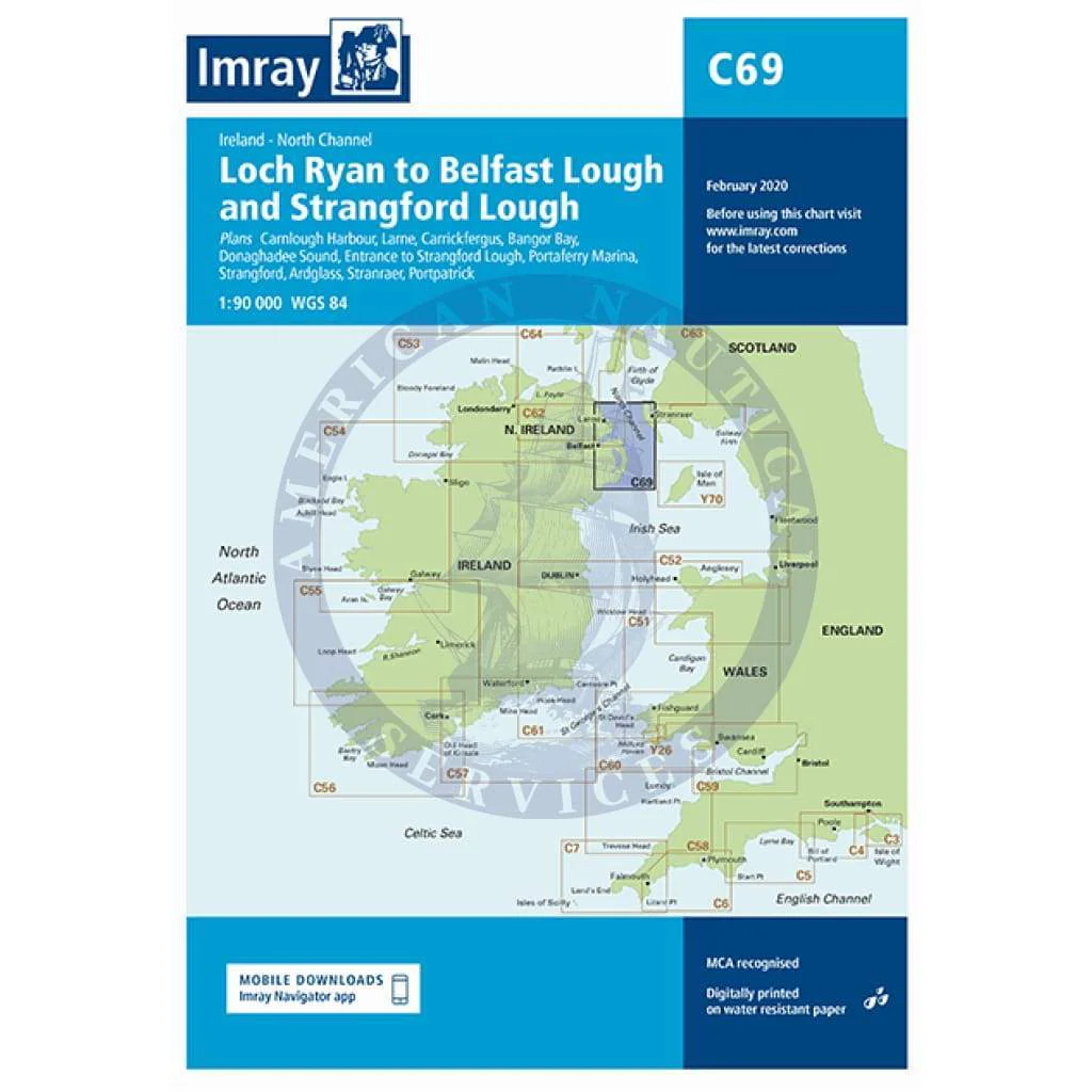
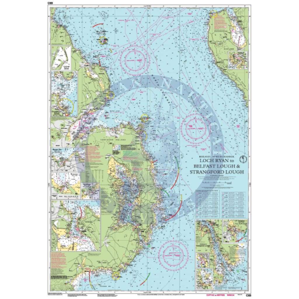
Imray Chart C69: Loch Ryan to Belfast Lough and Strangford Lough
C69 Loch Ryan to Belfast Lough and Strangford Lough
Scale: 1:90,000 WGS 84
Imray
Plans included:
Carnlough Harbour (sketch plan)
Larne (1:18 500)
Carrickfergus (1:15 000)
Bangor Bay (1:17 500)
Donaghadee Sound (1:25 000)
Entrance to Strangford Lough (1:37 500)
Portaferry Marina (1:7500)
Strangford (1:5000)
Ardglass (1:15 000)
Stranraer (1:12 500)
Portpatrick (1:6000)
On this 2018 edition the chart specification has been improved to show coloured light flashes. Depths have been updated from the latest surveys. The Marine Nature Reserve in Strangford Lough is included. There has been general updating throughout.
Waterproof Folded – This chart is waterproof, folded, and in a plastic wallet or flat.
Water-Resistant Rolled – This is a water-resistant print on demand (POD) chart that is printed up to date and is ideal for framing.
Informations sur le produit
Informations sur le produit
Livraison et retours
Livraison et retours
Imray Chart C69: Loch Ryan to Belfast Lough and Strangford Lough
Imray Chart C69: Loch Ryan to Belfast Lough and Strangford Lough
C69 Loch Ryan to Belfast Lough and Strangford Lough
Scale: 1:90,000 WGS 84
Imray
Plans included:
Carnlough Harbour (sketch plan)
Larne (1:18 500)
Carrickfergus (1:15 000)
Bangor Bay (1:17 500)
Donaghadee Sound (1:25 000)
Entrance to Strangford Lough (1:37 500)
Portaferry Marina (1:7500)
Strangford (1:5000)
Ardglass (1:15 000)
Stranraer (1:12 500)
Portpatrick (1:6000)
On this 2018 edition the chart specification has been improved to show coloured light flashes. Depths have been updated from the latest surveys. The Marine Nature Reserve in Strangford Lough is included. There has been general updating throughout.
Waterproof Folded – This chart is waterproof, folded, and in a plastic wallet or flat.
Water-Resistant Rolled – This is a water-resistant print on demand (POD) chart that is printed up to date and is ideal for framing.
Original : $34.95
-70%$34.95
$10.49Informations sur le produit
Informations sur le produit
Livraison et retours
Livraison et retours
Description
C69 Loch Ryan to Belfast Lough and Strangford Lough
Scale: 1:90,000 WGS 84
Imray
Plans included:
Carnlough Harbour (sketch plan)
Larne (1:18 500)
Carrickfergus (1:15 000)
Bangor Bay (1:17 500)
Donaghadee Sound (1:25 000)
Entrance to Strangford Lough (1:37 500)
Portaferry Marina (1:7500)
Strangford (1:5000)
Ardglass (1:15 000)
Stranraer (1:12 500)
Portpatrick (1:6000)
On this 2018 edition the chart specification has been improved to show coloured light flashes. Depths have been updated from the latest surveys. The Marine Nature Reserve in Strangford Lough is included. There has been general updating throughout.
Waterproof Folded – This chart is waterproof, folded, and in a plastic wallet or flat.
Water-Resistant Rolled – This is a water-resistant print on demand (POD) chart that is printed up to date and is ideal for framing.