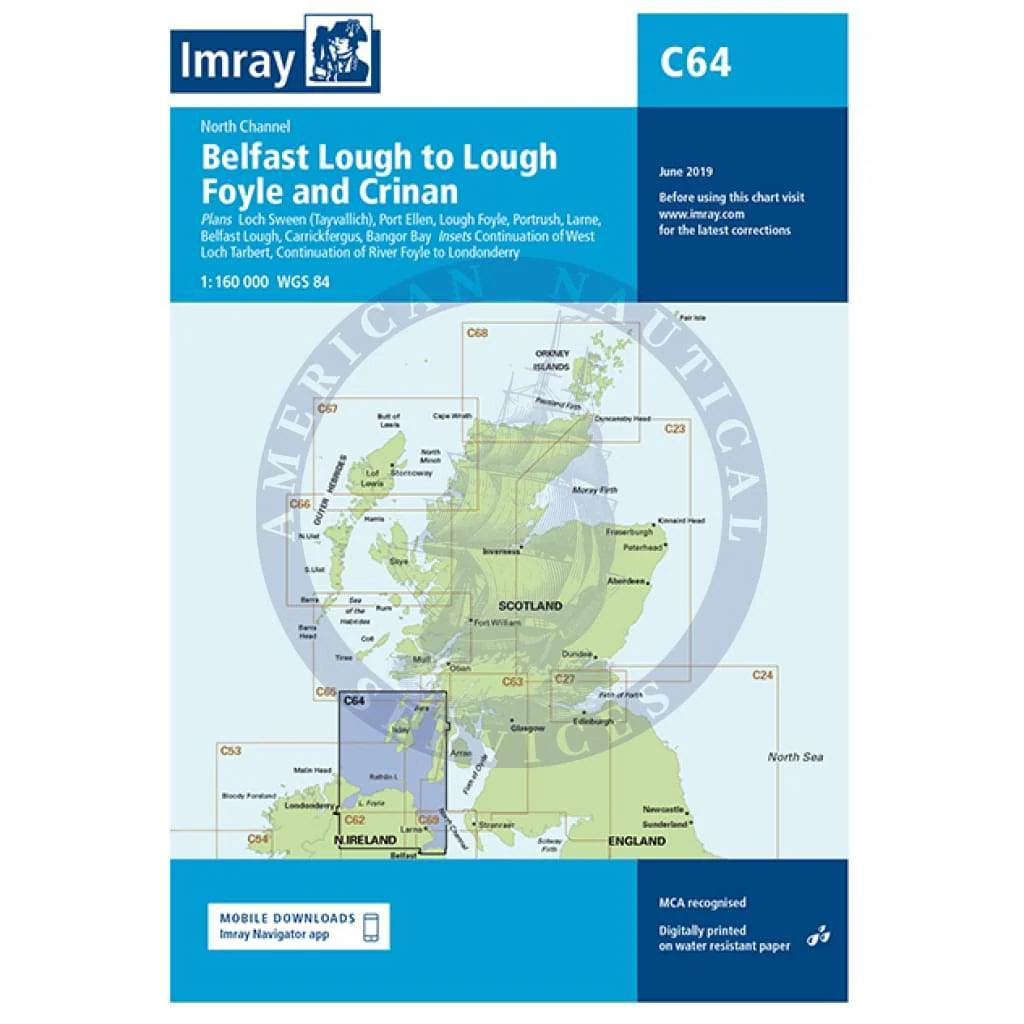
Imray Chart C64: North Channel - Belfast Lough to Lough Foyle and Crinan
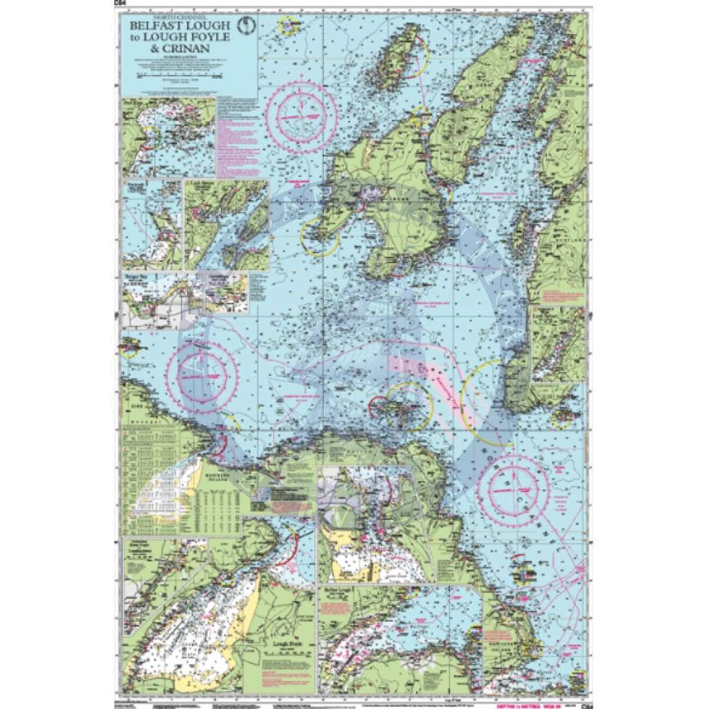
C64 North Channel - Belfast Lough to Lough Foyle and Crinan
Scale: 1:160,000 WGS 84
Imray
Plans included:
Loch Sween (Tayvallich) (1:25 000)
Continuation of West Loch Tarbert (1:65 000)
Port Ellen (1:25 000)
Lough Foyle (1:90 000)
Portrush (1:20 000)
Larne (1:18 500)
Belfast Lough (1:110 000)
Carrickfergus (1:15 000)
Bangor Bay (1:17 500)
Continuation of River Foyle to Londonderry (1:60 000)
On this edition the latest depth surveys have been applied along with general updating throughout.
Waterproof Folded – This chart is waterproof, folded, and in a plastic wallet or flat.
Water-Resistant Rolled – This is a water-resistant print on demand (POD) chart that is printed up to date and is ideal for framing.
Informations sur le produit
Informations sur le produit
Livraison et retours
Livraison et retours
Imray Chart C64: North Channel - Belfast Lough to Lough Foyle and Crinan
Imray Chart C64: North Channel - Belfast Lough to Lough Foyle and Crinan
C64 North Channel - Belfast Lough to Lough Foyle and Crinan
Scale: 1:160,000 WGS 84
Imray
Plans included:
Loch Sween (Tayvallich) (1:25 000)
Continuation of West Loch Tarbert (1:65 000)
Port Ellen (1:25 000)
Lough Foyle (1:90 000)
Portrush (1:20 000)
Larne (1:18 500)
Belfast Lough (1:110 000)
Carrickfergus (1:15 000)
Bangor Bay (1:17 500)
Continuation of River Foyle to Londonderry (1:60 000)
On this edition the latest depth surveys have been applied along with general updating throughout.
Waterproof Folded – This chart is waterproof, folded, and in a plastic wallet or flat.
Water-Resistant Rolled – This is a water-resistant print on demand (POD) chart that is printed up to date and is ideal for framing.
Original : $34.95
-70%$34.95
$10.49Informations sur le produit
Informations sur le produit
Livraison et retours
Livraison et retours
Description
C64 North Channel - Belfast Lough to Lough Foyle and Crinan
Scale: 1:160,000 WGS 84
Imray
Plans included:
Loch Sween (Tayvallich) (1:25 000)
Continuation of West Loch Tarbert (1:65 000)
Port Ellen (1:25 000)
Lough Foyle (1:90 000)
Portrush (1:20 000)
Larne (1:18 500)
Belfast Lough (1:110 000)
Carrickfergus (1:15 000)
Bangor Bay (1:17 500)
Continuation of River Foyle to Londonderry (1:60 000)
On this edition the latest depth surveys have been applied along with general updating throughout.
Waterproof Folded – This chart is waterproof, folded, and in a plastic wallet or flat.
Water-Resistant Rolled – This is a water-resistant print on demand (POD) chart that is printed up to date and is ideal for framing.