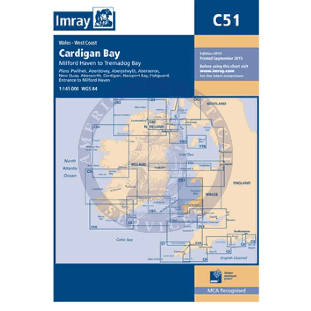
Imray Chart C51: Cardigan Bay
C51 Cardigan Bay
Milford Haven to Tremadog Bay
Scale: 1:145 000 WGS 84
Imray
Plans included:
Pwllheli (1:12 500)
Aberdovey (1:25 000)
Aberystwyth (1:15 000)
Aberaeron (1:20 000)
New Quay (1:20 000)
Aberporth (1:30 000)
Cardigan (1:40 000)
Newport Bay (1:35 000)
Fishguard (1:18 000)
Entrance to Milford Haven (1:30 000)
On this edition the chart has been fully updated throughout. Revised depths are shown at Aberdovey, Fishguard, the waters south of St David’s Head and in the entrance to Milford Haven.
Waterproof Folded – This chart is waterproof, folded, and in a plastic wallet or flat.
Water-Resistant Rolled – This is a water-resistant print on demand (POD) chart that is printed up to date and is ideal for framing.
Informations sur le produit
Informations sur le produit
Livraison et retours
Livraison et retours

Imray Chart C51: Cardigan Bay
Imray Chart C51: Cardigan Bay
C51 Cardigan Bay
Milford Haven to Tremadog Bay
Scale: 1:145 000 WGS 84
Imray
Plans included:
Pwllheli (1:12 500)
Aberdovey (1:25 000)
Aberystwyth (1:15 000)
Aberaeron (1:20 000)
New Quay (1:20 000)
Aberporth (1:30 000)
Cardigan (1:40 000)
Newport Bay (1:35 000)
Fishguard (1:18 000)
Entrance to Milford Haven (1:30 000)
On this edition the chart has been fully updated throughout. Revised depths are shown at Aberdovey, Fishguard, the waters south of St David’s Head and in the entrance to Milford Haven.
Waterproof Folded – This chart is waterproof, folded, and in a plastic wallet or flat.
Water-Resistant Rolled – This is a water-resistant print on demand (POD) chart that is printed up to date and is ideal for framing.
Original : $34.95
-70%$34.95
$10.49Informations sur le produit
Informations sur le produit
Livraison et retours
Livraison et retours
Description
C51 Cardigan Bay
Milford Haven to Tremadog Bay
Scale: 1:145 000 WGS 84
Imray
Plans included:
Pwllheli (1:12 500)
Aberdovey (1:25 000)
Aberystwyth (1:15 000)
Aberaeron (1:20 000)
New Quay (1:20 000)
Aberporth (1:30 000)
Cardigan (1:40 000)
Newport Bay (1:35 000)
Fishguard (1:18 000)
Entrance to Milford Haven (1:30 000)
On this edition the chart has been fully updated throughout. Revised depths are shown at Aberdovey, Fishguard, the waters south of St David’s Head and in the entrance to Milford Haven.
Waterproof Folded – This chart is waterproof, folded, and in a plastic wallet or flat.
Water-Resistant Rolled – This is a water-resistant print on demand (POD) chart that is printed up to date and is ideal for framing.