
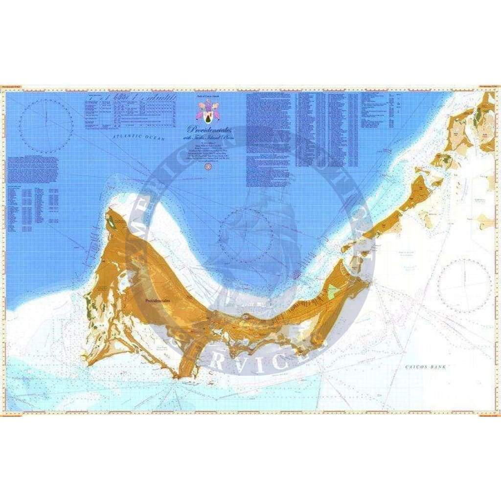
Providenciales Chart (Navigation Chart 24" x 36")
Shows the island of Providenciales at a large scale with waypoint list. The back side has plans of Turtle Cove Marina, Cooper Jack Marina, South Side Marina, North Shore – Turtle Cove to Leeward at large scale, Caicos Marina and Boatyard, South Shore – Sapodilla Bay to South Side Marina at large scale, Malcolm Roadstead anchorage, Molasses Reef anchorage, Seal Cays, West Sand Spit, North Creek – Grand Turk, Cockburn Town – Grand Turk, Fish Cays, Fort George Marine Park.
The plans include anchorage zones within national parks, marina approaches, anchorage restrictions and national park rules.
Informations sur le produit
Informations sur le produit
Livraison et retours
Livraison et retours
Providenciales Chart (Navigation Chart 24" x 36")
Providenciales Chart (Navigation Chart 24" x 36")
Shows the island of Providenciales at a large scale with waypoint list. The back side has plans of Turtle Cove Marina, Cooper Jack Marina, South Side Marina, North Shore – Turtle Cove to Leeward at large scale, Caicos Marina and Boatyard, South Shore – Sapodilla Bay to South Side Marina at large scale, Malcolm Roadstead anchorage, Molasses Reef anchorage, Seal Cays, West Sand Spit, North Creek – Grand Turk, Cockburn Town – Grand Turk, Fish Cays, Fort George Marine Park.
The plans include anchorage zones within national parks, marina approaches, anchorage restrictions and national park rules.
Informations sur le produit
Informations sur le produit
Livraison et retours
Livraison et retours
Description
Shows the island of Providenciales at a large scale with waypoint list. The back side has plans of Turtle Cove Marina, Cooper Jack Marina, South Side Marina, North Shore – Turtle Cove to Leeward at large scale, Caicos Marina and Boatyard, South Shore – Sapodilla Bay to South Side Marina at large scale, Malcolm Roadstead anchorage, Molasses Reef anchorage, Seal Cays, West Sand Spit, North Creek – Grand Turk, Cockburn Town – Grand Turk, Fish Cays, Fort George Marine Park.
The plans include anchorage zones within national parks, marina approaches, anchorage restrictions and national park rules.


