British Admiralty Routeing Chart 5149: South China Sea
Looking to go digital with your Passage Planning? Check out our Simple E-Navigation Software, SPICA!
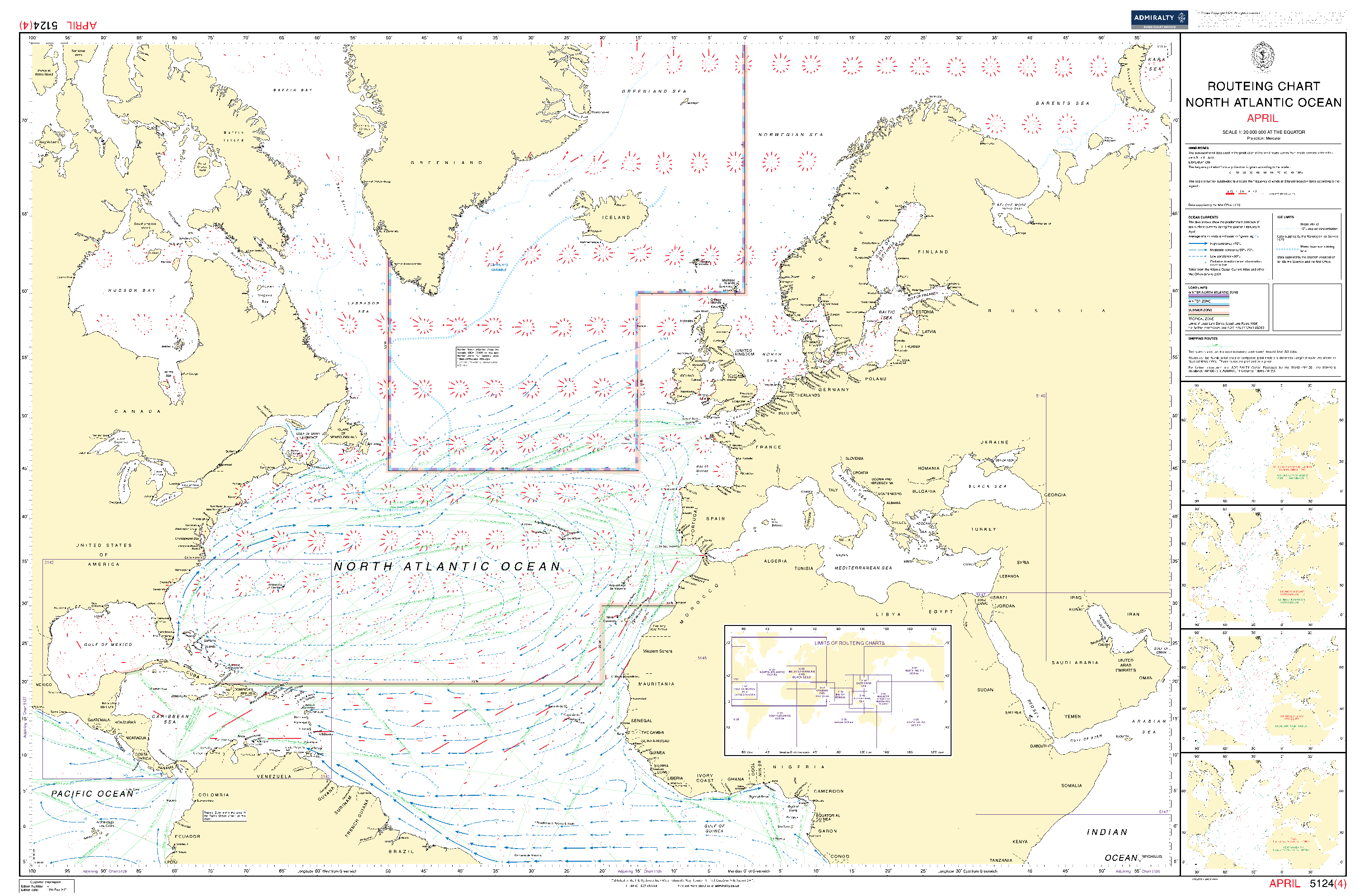
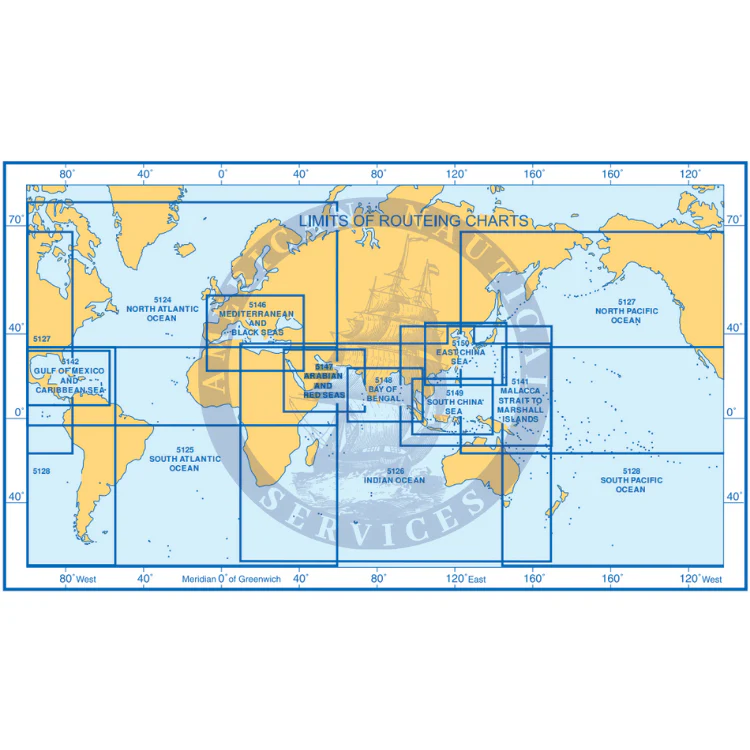
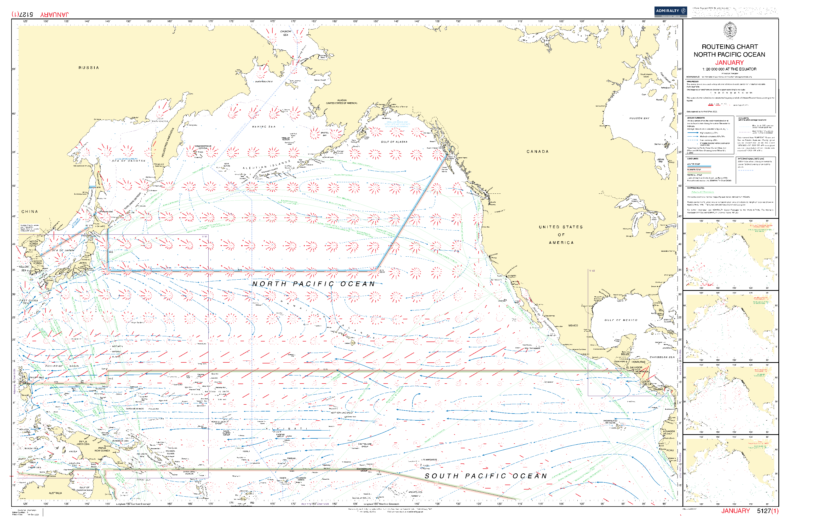
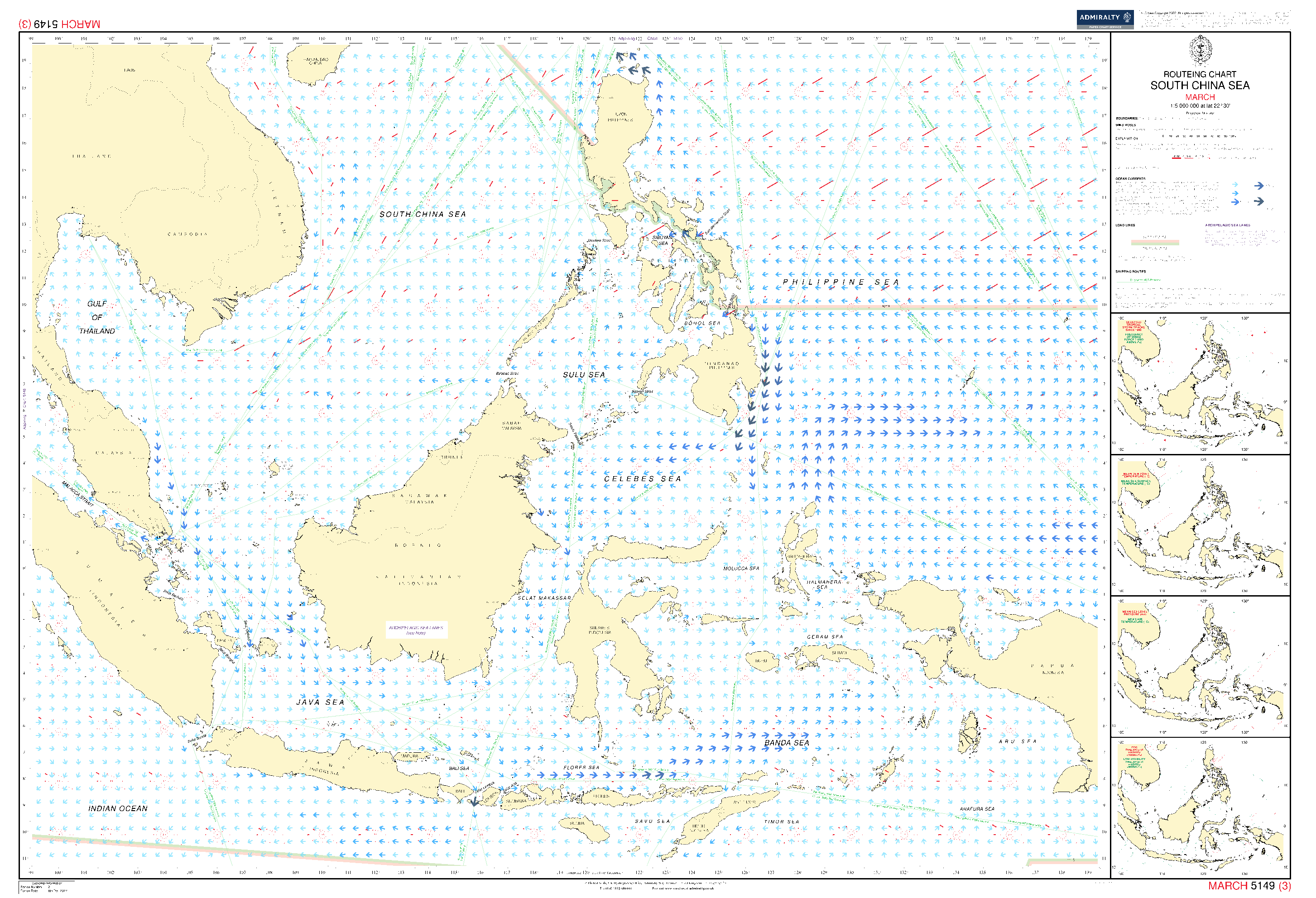
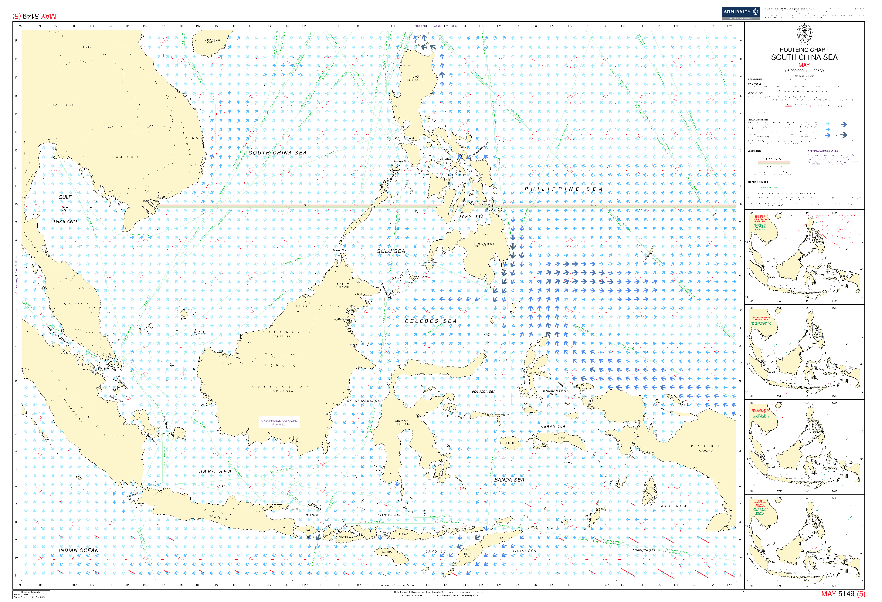
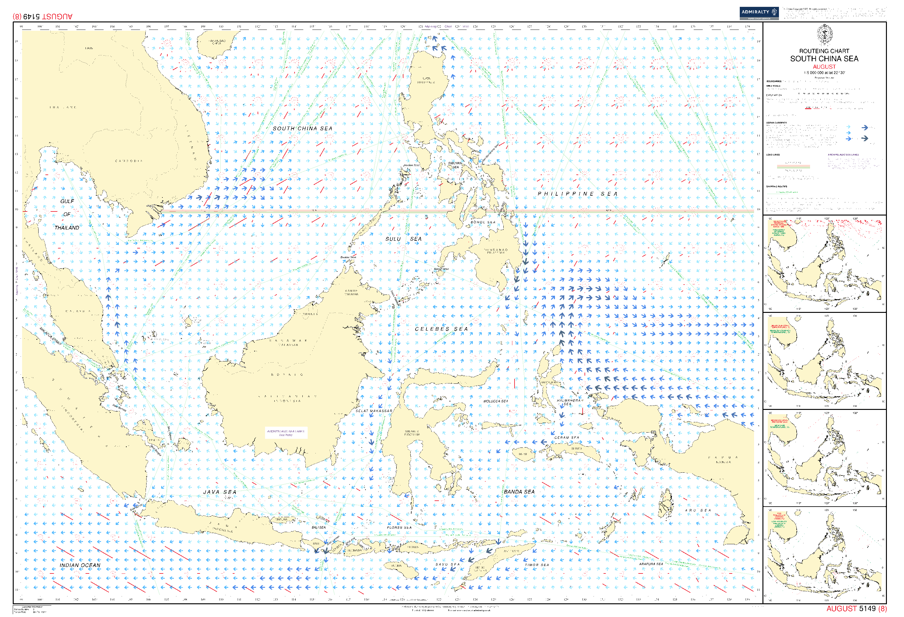
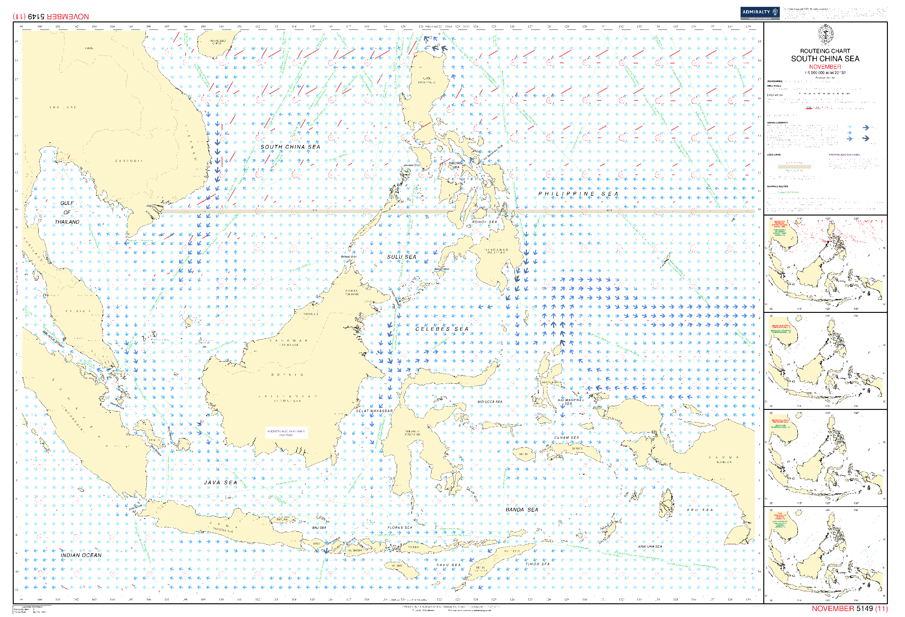
Essential for use in passage planning for ocean voyages, Routeing Charts include routes and distances between major ports, ocean currents, ice limits, load lines and wind roses. They also contain expected meteorological and oceanographic conditions for each month of the year.
- Individual chart scales of 1:5,000,000, 1:10,000,000 and 1:20,000,000 to assist bridge crews in high-level route planning
- Information including wind roses showing wind speed and direction, the frequency and intensity of storms and low pressure, ocean currents, sea and air temperatures, air pressure and ice limits based on data averages
-
Each charted area contains 12 separate charts for each calendar month, covering meteorological and oceanographic conditions that change throughout the year
Admiralty Routing Paper Charts (United Kingdom Hydrographic Office – UKHO)
Informations sur le produit
Informations sur le produit
Livraison et retours
Livraison et retours


British Admiralty Routeing Chart 5149: South China Sea
British Admiralty Routeing Chart 5149: South China Sea
Looking to go digital with your Passage Planning? Check out our Simple E-Navigation Software, SPICA!
Essential for use in passage planning for ocean voyages, Routeing Charts include routes and distances between major ports, ocean currents, ice limits, load lines and wind roses. They also contain expected meteorological and oceanographic conditions for each month of the year.
- Individual chart scales of 1:5,000,000, 1:10,000,000 and 1:20,000,000 to assist bridge crews in high-level route planning
- Information including wind roses showing wind speed and direction, the frequency and intensity of storms and low pressure, ocean currents, sea and air temperatures, air pressure and ice limits based on data averages
-
Each charted area contains 12 separate charts for each calendar month, covering meteorological and oceanographic conditions that change throughout the year
Admiralty Routing Paper Charts (United Kingdom Hydrographic Office – UKHO)
Original : $2,800.00
-70%$2,800.00
$840.00Informations sur le produit
Informations sur le produit
Livraison et retours
Livraison et retours
Description
Looking to go digital with your Passage Planning? Check out our Simple E-Navigation Software, SPICA!
Essential for use in passage planning for ocean voyages, Routeing Charts include routes and distances between major ports, ocean currents, ice limits, load lines and wind roses. They also contain expected meteorological and oceanographic conditions for each month of the year.
- Individual chart scales of 1:5,000,000, 1:10,000,000 and 1:20,000,000 to assist bridge crews in high-level route planning
- Information including wind roses showing wind speed and direction, the frequency and intensity of storms and low pressure, ocean currents, sea and air temperatures, air pressure and ice limits based on data averages
-
Each charted area contains 12 separate charts for each calendar month, covering meteorological and oceanographic conditions that change throughout the year
Admiralty Routing Paper Charts (United Kingdom Hydrographic Office – UKHO)